About Peru
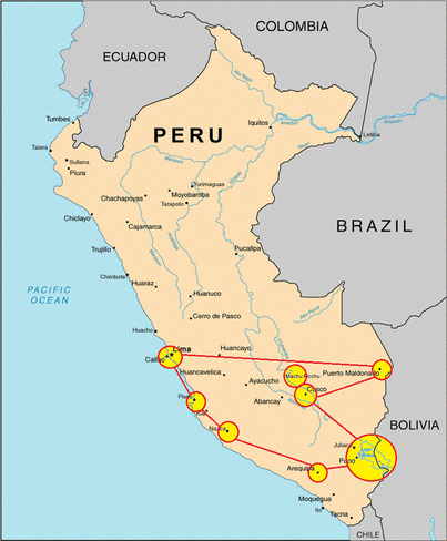
Peru is South America's third largest country, covering 1,285,215 sq. km., and can be divided into three distinct geographic regions. The best known of these is the central high sierra of the Andes, with its massive peaks, steep canyons, and extraordinary pre Columbian archaeological sites. The Andes are still one of the world's most unstable mountain ranges, with frequent earthquakes, landslides, and flash floods. Despite such instability, the Andes are also the site of the most fascinating pre-Columbian cities of South America-like the great city of the clouds, Machu Picchu.
The Andes are by no means the only region to visit in Peru. Also of great interest is Peru's narrow, lowland coastal region, a northern extension of the Atacama Desert. Although the Atacama is generally known as the most arid region on the planet, the climate along Peru's shores is made cooler and less dry by La Garuùa, a dense fog created by the collision of the frigid waters of the Humboldt Current with the heated sands of the Atacama. Lima, Trujillo, and Chiclayo, three of Peru's major population centres, are located along this coastal desert.
Peru's third great region is the dense forest that surrounds the headwaters of the Amazon beneath the eastern slopes of the Andes. This part of the country is so inaccessible that only the most adventurous and intrepid travelers should attempt to penetrate its mysterious emerald depths. In fact, the region's capital of Iquitos, a city of 400,000, is accessible only by air or by boat up the Amazon.
Peru's climate varies considerably by region, although January through March tends everywhere to be the wet season. The coastal areas, which are quite hot and humid during those months, are cooled during the rest of the year by La Garuùa. The fog doesn't penetrate very far inland, however, and the western side of the Andes are very clear, warm, and dry for the greater part of the year. As one moves up into the mountains, night-time temperatures become considerably colder. The eastern slope of the Andes, like the Amazon basin, experiences very heavy rainfall during the wet season, which extends from January all the way through April.
History & Culture
Peru is best known as the heart of the Inca empire, but it was home to many diverse indigenous cultures long before the Incas arrived. Although there is evidence of human habitation in Peru as long ago as the eighth millennium BC , there is little evidence of organized village life until about 2500 BC. It was at about this time that climatic changes in the coastal regions prompted Peru's early inhabitants to move toward the more fertile interior river valleys. For the next 1500 years, Peruvian civilization developed into a number of organized cultures, including the Chavìn and the Sechìn. The Chavìn are best known for their stylized religious iconography, which included striking figurative depictions of various animals (the jaguar in particular) and which exercised considerable influence over the entire coastal region. The Sechìn are remembered more for their military hegemony than for their cultural achievement.peru03.jpg (25202 bytes)
The decline of the Chavìn and Sechìn cultures around the 5th century BC gave rise to a number of distinctive regional cultures. Some of these, including the Saliner and the Paracas, are celebrated for artistic and technological advances such as kiln-fired ceramics and sophisticated weaving techniques. From the Paracas arose the Nazca, whose legacy includes the immense and cryptic Nazca Lines. However, the accomplish- ments of these and other early Peruvian civilizations seem today to pale in comparison to the robust pre-Columbian civilization of the Inca.
The most startling feature of the great Inca empire was its brevity. In 1430, the realm of the Inca consisted of little more than the river valley around Cuzco. Less than a century later, through conquest and a canny policy of incorporating the best features of the societies they subjugated, the Incas controlled a vast territory of almost 1 million square kilometers--a dominion that extended from northwest Argentina to southern Colombia. The Incan capital, at Qosqo, was undoubtedly the richest city in all of the Americas, with temples literally sheathed in heavy gold plate. Although Qosqo's architecture remains only in fragments and foundations, the architectural accomplishment of the Inca's has survived intact at the astounding ceremonial centre of Machu Picchu.
In 1532, at the height of its power, the Inca empire was driven by a war of succession. In one of the great tragedies of history, it was at precisely this moment that Francisco Pizarro and his band of Spanish conquis- tadors arrived on the scene. Showing an uncanny ability to turn circumstances to his own advantage, Pizarro used deception and guile to gain a personal meeting with Atahualpa, the Inca ruler, whom he coolly assassinated. In the face of fierce resistance, Pizarro and his men seized Cuzco and sacked the city. Although the Incas continued to fight for the next several years, their empire had ended and Spanish rule had begun.
Peru's population of about 23 million is divided almost equally between the highlands and the population centres of the coast, and the division marks a sharp cultural as well as geographic divide. The inland peru04.jpg (20126 bytes)regions are marked by extreme poverty and subsistence agriculture, while the fertile river valleys of the lowlands have produced a wealthier, more cosmo- politan culture. Almost half of Peru's people are Indian, while another one third or so are mestizo. About ten percent are of European descent, and there are significant African and Asian minorities. Although Spanish is Peru's official language, a multitude of indigenous languages continue to hold sway in the highlands.
Exploration
For practical purposes Peru can be divided into three major regions: the central Andean highlands, the long, low coastal strip, and the remote eastern vastness of the Amazon basin. The best-known of these regions, the Andes, is also home to Huascaràn, the country's most celebrated park and South America's premier mountaineering and trekking destination. The mountains are home to the Andean condor, Andean geese, puna ibis, and many types of hummingbirds, plus llama, alpaca, guanaco, vicuna, paramo. Several species of hardy plants also thrive, including Polylepis, a small shrub that grows at a higher elevation than any other in the world.
Qosqo (Cuzco)
This colorful, picturesque town was once the center of the Inca Empire, and with almost 300,000 residents it remains an important city. Although Qosqo was heavily damaged by the Spaniards (whose architectural legacy is obvious), the Inca city is still very much in evidence. Walls, doorways, foundations, arches, and even decorative stonework are found throughout the city, incorporated into newer structures like fragments of a broken mosaic. Qosqo also contains some more extensive Inca ruins, including the Temples of the Sun and the Moon. The city is also the acclimatization point for the celebrated high altitude trek along the trail of the Incas.
The Inca Trail & Machu Piccu
This 3-5 day journey is widely considered to be the most spectacular trekking experience on the continent. Its route passes through a 13,000-foot Andean pass beyond which lie some of the most astounding artifacts of the Inca civilization. Most of these attractions, unlike the majority of large pre- Columbian structures, lay completely undisturbed for hundreds of years, and much of the trek's fascination is imparted by the sensation of trekking into a region sealed off from time. Starting with the sentry post of Runkuraqay, hikers pass through increasingly splendid ruins, surrounded all the while by ice- capped mountains and forests.
The trail ends at the astonishingly well-preserved sacred city of Machu Picchu, having retraced the route by which the Incas themselves ascended to this ceremonial centre. Gazing across the ruins, with its perfectly set stairways, dwellings, fountains and still functional aqueducts, is a haunting experience; so intact is the city that at times it seems its residents have only recently walked away. How Machu Picchu's legecy ended is a great mystery. It was once filled with priests, artisans, and the mamacunas, a group of select virgins who dedicated their lives to the sun god. The Spanish have no records of the city, and when it was rediscovered in 1911, its walls overrun by the nearby jungle, only 173 skeletons were found on the site.
Parque Nacional Huascaràn
Far to the north of Lima, this park occupies a one-hundred mile stretch of the Cordillera Blanca, an area of the Andes that is renowned as one of the most exciting trekking regions of South America. Part of the reason for this excitement is the area's incredible concentration of dramatic, snow-capped mountains --more than twenty-five of its peaks exceed 19,500 feet. The center of trekking activity in the park, and in its surrounding region, is the modest city of Huaràz. Treks of all sorts, for beginners as well as for experts, and lasting anywhere from one day to ten, are easily arranged. Huascaràn, Peru's tallest mountain at 22,200 feet, is the centerpiece of the park and is a challenging and celebrated mountaineering destination. In the southern section of the park is found the Puya, or Cunco, one of the world's most fascinating plants. A living fossil, the Puya is an enormous bromeliad thought to have first grown in the low swamps that occupied the area long before the Andes were formed. As the mountains grew, over countless millenia, the puya grew with them, evolving into enormous, thirty-foot high, tree-like denizens of the high Andes. They are dramatic plants, bursting into bloom with an enormous spike that bears up to 8,000 brilliant green blossoms. The thorny leaves that crown the puya are requently strewn with the impaled carcasses of inattentive songbirds.
Arequipa
Arequipa is Peru's second largest city, the major city of the southern part of the country, and, in the minds of its proud residents, virtually an independent city-state. It is also known as the white city, as much of its architecture is con- structed of sillar, a light-coloured volcanic rock. Arequipa lies in a picturesque valley fringed by beautiful mountains, includ- ing the snowcapped volcanic cone of El Misti. The area is noted for high seismic activity, which has been sufficiently frequent to erase all of Arequipa's earliest structures. Although evidence of pre- Columbian settlement exists, even the buildings erected by the 'founding' Spaniards in 1540 have long since disappeared. However, if Arequipa has lost its very earliest buildings, it still enjoys an abundance of very fine seventeenth and eighteenth century buildings. The most notable of these is the Convent of Santa Catalina, which when opened to the public in 1970 revealed a world of luxurious seclusion that had been sealed off from the world for almost four centuries.
Colca Canyon
To this day, there is no agreement as to whether Colca Canyon is the deepest terrestrial chasm in the world, but no one challenges the fact that it is one of nature's most awe-inspiring sights. Standing on the canyon's edge, the great expanse of space overwhelms the senses, commanding respect for nature's creative forces. Carved over eons by the Colca River, it stretches about 60 kilometers from its eastern extremity at the town of Chivay to Cabanaconde, in the west. By the time the river reaches Cabanaconde, it has fallen about 1,300 meters in elevation.
Though the canyon received surprisingly little attention from western explorers until this century, it was well-known even before the Incas. In some places, stone-supported terraces built by the Incas and their predecessors trickle down the canyon slopes, many of them still functional. Small towns and villages sit atop the canyon banks on both sides, beginning with Chivay, which is known for its hot springs and as the main portal for exploring the chasm. Moving west on the canyon's southern edge, travellers encounter the villages of Achoma and Maca, where local women wear intricate and colourful mountain dresses identical to those of their ancestors. At the nearby Mirador ruz del Condor, visitors are often blessed with visions of rare, giant Andean condors as they ride the morning thermals rising from the canyon floor.
Trekking in the Colca Canyon
The nine villages lining the edges of the canyon provide trekkers with a host of connect-the-dots routes, allowing for a great deal of improvisation in one's itinerary. There are numerous points of descent into the canyon, though their accessibility often depends upon the amount of rainfall. When travel ing in the canyon, it is essential that trekkers bring plenty of water, as dehydration can occur rapidly here.
